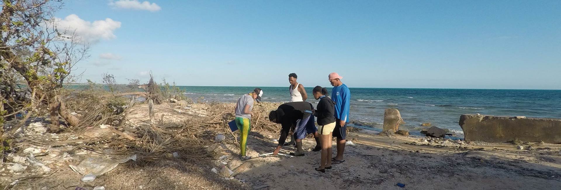

UM biology professor uses coastal ecology and citizen science to analyze storm risk to life and property in the Bahamas, supporting data-driven policies.
Engaging communities and encouraging citizen science is key to successful data-driven coastal management policy. Without this, says Kathleen Sullivan Sealey, you don’t have the trust or investment in the data that needs to drive the policy.
“Data-driven policy is not natural because people make political decisions based on emotions,” says Sullivan Sealey, an associate professor in biology at the University of Miami’s College of Arts and Sciences. “Science is always viewed as being rational, incremental, very slow, but somehow you have to marry the two when you’re looking at climate change and flooding risk.”
And that’s been exactly the aim with her recent work in the Bahamas, conducting storm impact and risk assessments throughout the Caribbean islands, involving data-backed recommendations for coastal management, coastal restoration, and public outreach and education.
Often, the financial industry and government are not looking at broader ecological changes and scientific data, explains Sullivan Sealey, unlike insurance companies that are “way out ahead of the curve because they could lose billions.”
Sullivan Sealey, a coastal ecologist who is creating a database that will help make better coastal development decisions, undertook two recent studies in the Bahamas with the hopes of making her data publicly accessible and sharing it with the island’s government to improve its decision-making when balancing short- and long-term costs and benefits.
About the Photo
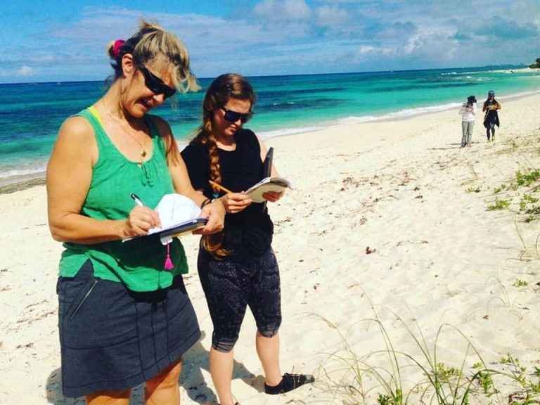
Young Marine Explorers interns and UM Coastal Ecology students survey for trash near the Marshall Road boat ramp in New Providence, The Bahamas. Photo courtesy of: UM Coastal Ecology Lab
Join the Conversation:
Follow on Twitter:
UM Coastal Ecology Lab, @UMCoastalEcology
UM College of Arts and Sciences, @UMCAS
University of Miami,
@univmiami
UM News, @univmiaminews
One study was a hurricane loss risk assessment of coastal properties on the island of Exuma, modeling storms of varying intensities and properties, such as heavy wind and/or storm surges. The other study analyzed the impacts of hurricanes, with a focus on Hurricane Matthew, on coastal stability in New Providence, Bahamas.
For the project in Exuma, Sullivan Sealey worked with economist Eric Strobl to model and simulate storms over the next 100 years and examined the probabilities of risk to the hotels and properties there, depending on how close the buildings were to the beach and what was the elevation.
“This was really to get people to realize that putting these large infrastructure projects and resorts so close to the beach is maybe not the best idea and that, considering that this would have hundreds of jobs tied to that resort, it should be built in a more secure area,” Sullivan Sealey says.
(Story continues after photo gallery)
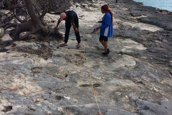
The project in New Providence involved recording the damage to the coast in the wake of Hurricane Matthew in 2016, highlighting the need for coastal zone restoration and improved management. Sullivan Sealey and her team documented where the worst damage occurred and why it was so bad—because development was too close to the coast or people removed all the sand from the dunes to make concrete, for example.
The UM researchers engaged local citizen scientists on the Bahamian island, working with a group called Young Marine Explorers, teens and young adults who work in underserved communities in the area.
“We just finished about two and half months of going around New Providence looking at richer and poorer neighborhoods where the hurricane hit,” says Sullivan Sealey, who has a Bahamian passport and has spent much of her life on islands. “We found that there’s a huge disparity in the effects of the hurricane that is related to the disparity of income distribution.”
“That was very striking,” she continues. “The most high-risk areas are low-income neighborhoods in the most vulnerable areas. And the government needs to do something about that.”
In conducting these risk analyses, Sullivan Sealey aims to not only make her data publicly accessible to all, but also to meet with and present the data to policymakers to convey the benefits of long-term thinking.
“For example, passing up making $30 million this year because it means saving $100 million in the long-term by adapting resorts, property and infrastructure to be more resilient to storms, and reducing risks and vulnerabilities to climate change impacts and sea level rise.”
Sullivan Sealey explains that when it comes to Small Island Developing States, known as SIDS, it’s a balance, Sullivan Sealey notes, between government regulation, corporate responsibility, and consumer or tourist awareness.
“All those things have to come together,” she adds. “There are a lot of market forces at play incentivizing investors to build properties that are vulnerable to storms, flooding, climate change and coastal degradation. But it can’t be the government alone that regulates coastal development or the resorts and investors designing development in a vacuum.”
It’s a concerted effort at collaboration among stakeholders.
“It’s all about public-private partnerships, checks and balances, and engaging the community,” says Sullivan Sealey. “What the SIDS in particular, and developing countries generally, are realizing is that money is not the solution. What’s really important is good governance and careful planning, what would be called a ‘prudent course of action.’”
There’s also the challenge, adds Sullivan Sealey, of moving from the environmental activist perspective, where constant proclamations of the dangers of climate change and sea level rise go unheeded, to actually putting a risk map and a plan before decision-makers.
“To show them where the most vulnerable areas are, where they need to fix first and focus resources, how much it’s going to cost, the long-term savings in prevented loss, and how many people would be protected,” says Sullivan Sealey.
From the risk analysis project in Exuma, the researchers developed maps of various locations on the island. These maps, colored red, orange, yellow and blue, underscore the risk level, from high to low, of flooding over the next 40 years. In the Bahamas, hurricanes don’t hit often, but when they do, the damage tends to be severe.
There’s another nuance of public perception on how flood risk is determined and what sea level rise means to them.
“Locals will ask, ‘Why did you put my house in the flood zone? You really think my house is going to flood? It’s never flooded before,’” says Sullivan Sealey.
Sullivan Sealey is slated to present her data and science-backed coastal recommendations to Bahamian government officials early this summer. She is cautiously optimistic the government will accept her expertise and act on her advice, especially after experiencing Matthew and Joaquin, two majoring hurricanes, in the past two years.
“All you can do is plant the seed and put it out there,” says Sullivan Sealey, who is proud that her work fits into UM’s core principles of making research cross-disciplinary and relevant to societal issues. “You don’t know where it’s going to go, but the more people you make aware of the risks, and the more people know there’s a problem, the more they realize our recommendations are a viable course of action.”
- JESSICA M. CASTILLO / UM News
